What is a Phase 1 Desk Study?

A Phase 1 Desk Study is an interpretive report that provides detailed information on the likely presence of any contamination within the subsurface of the development site. A phase 1 Desk study highlights the sites historical, geological and environmental setting, and the potential risks that this may present to future site users, developments and the immediate environment.

A phase 1 desk study is required before ground investigation. Ideally it should also be accompanied by a walk over survey conducted by an experienced practitioner. By compiling available information in relation to a site’s environmental, geological, hydrogeological, hydrological and mining setting a cost effective and focussed site investigation will be developed

Get an Instant Phase 1 Desk Study Quote and Buy Online

Phase 1 Desk Study Geotechnical Report

Phase 1 Desk Study with a FIXED PRICE

Phase 1 GeoEnvironmental Desk study — With a site walkover survey — £800 +VAT

We offer a fixed price of £800 + VAT for a Comprehensive Phase 1 GeoEnvironmental Desk Study. This includes a site walkover survey of a site that is less than 5 hectares in size.

Phase I GeoEnvironmental Desk study — Without a site walkover survey  — £550 +VAT

A Basic Phase 1 GeoEnvironmental Desk Study report without a site walkover survey would be provided for a fixed price of £550 +VAT

Earth Environmental & Geotechnical provide a wide range of Desk Study services, click here to contact us for further information.

What is a Phase 1 Desk Study?

A Phase 1 Desk Study is a preliminary risk assessment of a site. The report collates information from a wide range of sources relating to the sites environmental, geological, hydrogeological, hydrological and mining setting

The

setting a cost effective and focussed site investigation will be developed

Paypal and credit card logos
Phase 1 Desk Study
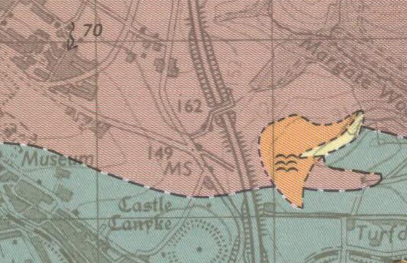
Geology plan for desk based study

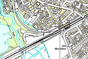
Typical information gathered as part of the development of a desk based study includes (It should be noted that not all sources of information will be used within every desk study, e.g. coal mining search  not required in non-mining district):

  • Historical Maps
  • Service Search
  • Unexploded Bombs (UXO)
  • Local Authority Search
  • Petroleum Licencing record of fuel tanks/spills
  • Geological Maps, Memoirs and Specialist Reports
  • Previous Site Investigation Information including reports and boreholes
  • River/Sea/Groundwater Flood Maps
  • Radon Potential
  • Soil Quality Mapping
  • BGS Geochemistry Data
  • HSE records of abandoned metalliferous mines
  • MAFF records for burial pits
  • Brine Subsidence
  • Aerial Photographs
  • Active/Closed Landfill Sites
  • Mining Report including Shafts/Adits and Mineworkings
  • Ecological Geographical Based Systems
  • Local Library Archive Records
  • National Monument Records
  • Water Discharge Consents
  • Pollution Incidents
  • Previous Planning Applications
  • Contamination Land Regulations Status
  • Hydrogeological maps and aquifer status
  • Surface and groundwater abstractions

Development of Brownfield Sites

Development of Brownfield Land : Focus for Housing Development

, ,
The development of Brownfield land will continue to be a focus for the next few years in the aim to provide much needed housing throughout the UK. The Government hopes to transform unused and derelict buildings, while making the most of brownfield land. Also to tackle the housing shortage in urban areas by enabling commercial premises to be converted into new homes through a fast-track planning permission process.
The Manchester and Salford Planning Handbook

The Manchester and Salford Planning Handbook

, ,
The Manchester and Salford Planning Handbook is out today with advice on the “ins and outs” of the planning system in England, check out page 37 featuring Earth Environmental & Geotechnical and our list of Services call now to discuss your new development. Tel:0161 975 6088
10 Years of Business providing Geotechnical Consultancy Services

Conducting Ground Investigation | Site Investigation

,
What Could Delay Your Development Construction? More than 50% of construction projects are delayed by adverse site conditions or unexpected ground conditions. Conducting detailed Site Investigation / Ground Investigations can save you time and money. There are many reason’s a development can be delayed, but one of the key factors that will affect a development is knowing what you are building on.
Slope Stability Assessment

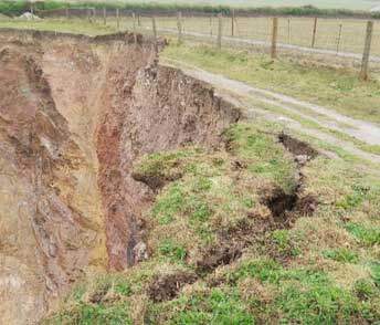
Geotechnical Appraisal Cliff Collapse Newquay Cornwall

,
Earth Environmental & Geotechnical (Southern) Ltd were commissioned to undertake a Geotechnical Appraisal for cliff stability of a site near Watergate Bay in Newquay, Cornwall. HM Coastguard had reported a section of the cliff had collapsed in early 2020. As part of the study, a Phase I Desk Study was carried out, including obtaining a site-specific geological and ground stability report.
Phase 1 Desk Study

What Is A Phase 1 Desk Study?

,
A Phase 1 Desk Study is a risk assessment report for a development site. For planning applications to be approved, your council needs to know that your development carries no risk to human health or the wider environment. As part of the Phase 1 Desk Study information about the site is collected from a wide range of available documents