Coal Mining Risk Assessments (CMRA) for Planning Applications
Here at Earth Environmental & Geotechnical we are routinely commissioned to provide Coal Mining Risk Assessments (CMRA) for planning applications.
A CMRA is required when a relevant development falls within a Coal Authority development high risk area, due to either former underground workings, potential shallow mineworkings, or abandoned mineshafts.
A recent project highlighted that the Coal Authority Mining Report can in some cases be inaccurate and can blight sites, even when there is no apparent risk from shallow coal mine activity.
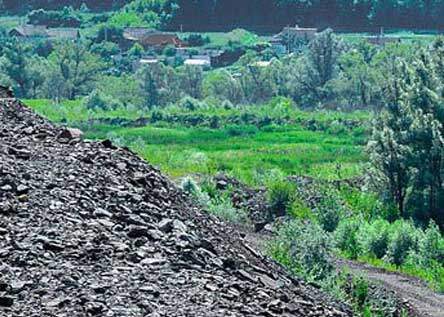
The site in question is located within a beautiful location on the outskirts of Glasgow, overlooking a valley in a greenfield setting. The development, a new eco-friendly and sustainable house would be built near to the crest of a slope, subject to further assessment of slope stability and ground conditions for foundation design.
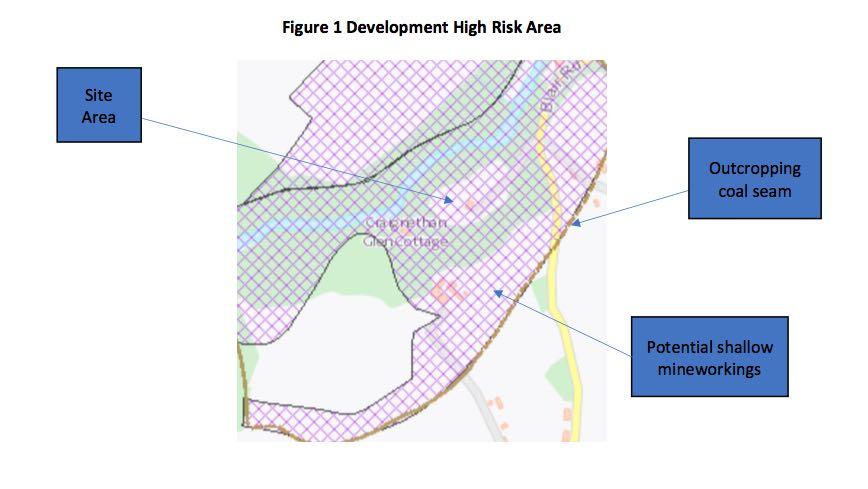
Examination of the Coal Authorities Interactive Viewer shows that the site lies within a Development High Risk Area due to a locally outcropping coal seam. The prevailing dip direction (ten degrees to the north) implies that the coal seam would underlie the site at a shallow depth and therefore potentially poses a risk of future subsidence.
A Coal Authority Mining Report
A Coal Authority Mining Report was acquired to further examine available records and interestingly this did not mention any locally outcropping coal seams or past coal mining activity within the area. It did however suggest probable unrecorded shallow mine workings, despite the absence of any nearby outcropping coal seams.
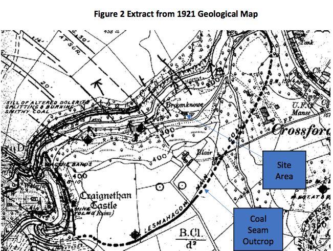
The source information for the Coal Authority Interactive Viewer was then researched and found to originate from a 1921 geological map Lanarkshire Sheet 24NE (Figure2).
The Lesmahagow Main Gas coal seam is inferred to outcrop to the south of the site, with a thickness of 0.1m to 0.25m with an underlying ironstone seam. The outcrop is partially proven to the southwest of the site but is inferred nearer to the site.
Interestingly north of the river gorge an underground dip is shown possibly associated with the Lesmahagow Main Gas coal seam.
Nearer to the site several faults have been mapped in the river gorge and underground coal seams.
Based on the 1921 the coal mining regime appears simple. A locally outcropping and formerly important coal seam, dipping to the north, and potentially worked, entirely justifying a Development High Risk characterisation of the site and the immediate area.
Except further evidence reveals a different geological model and interpretation of the local coal mining regime.
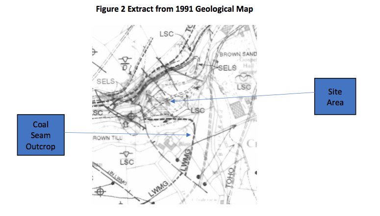
Figure 3 (below) shows an extract from geological map Sheet 84NW dated 1991.
This updated map shows that the Lesmahagow Main Gas coal seam does not underlie the site due to localised folding and faulting. The revised outcrop position has been conjectured from a series of boreholes that were drilled in the area, but not shown on the geological map.
Interestingly the map also shows the Tower coal seam overlying the Lesmahagow Main Gas coal seam, which is not shown on the earlier edition. The Lesmahagow Main Gas coal seam is also split into three partings, 0.22m, 0.46m and 0.38m thick.
As a result, it can be demonstrated that the Lesmahagow Main Gas does not underlie the site and therefore the risk of shallow coal mining activity can be discounted.
What are the lessons to be learned?
a) A CMRA should always be developed by a Chartered Geologist (CGeol). Geologists are well versed in how to interpret geological, borehole records and mining maps. Much of the information on a map is based on interpolation and interpretation.
b) A CMRA should always, wherever possible be based on 1/10,000 or 1/10,560 scaled geological maps. To many reports rely on 1/50,000 scaled maps which often do not contain sufficient detail to appreciate complex geological settings.
c) The Coal Authority database of mining records is vast and a valuable national resource. There are however anomalies and some Development High Risk Areas have been assessed using outdated maps. Always check data provenance.


